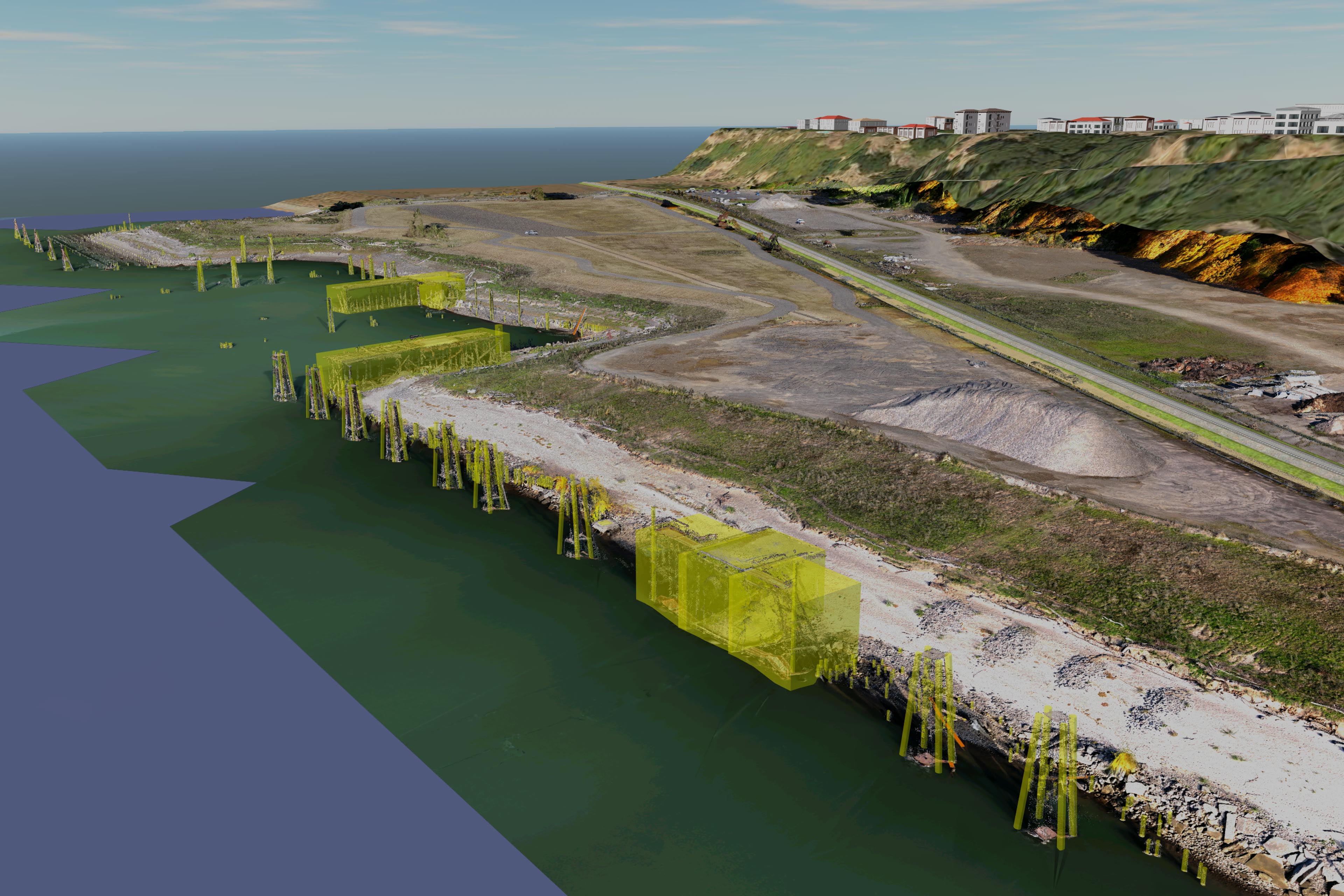
I recently completed a unique project for Statewide Land Surveying. This project was on the shore of the Willamette River just below the University of Portland. The client was looking to have the exact location of some old offshore pilings located for the shoreline they were developing. Because they were offshore and there were so many of them SWLS gave me a call to ask if I could digitize them from a photo-derived point cloud captured by UAV. I had recently captured some offshore objects doing some work for Mike Magyar in Astoria so I was confident I could also capture the ones in the Willamette.

I flew several missions at varying heights to ensure I captured enough land on the shore to tie the imagery together. Construction on the site had recently been completed and there was just a little bit of grass growing. This meant that I would also be able to make a very accurate surface model of the entire location to compare to the surface model SWLS created using traditional survey methods. Once I had processed the data through Pix4D georeferencing the data with surveyed air targets by SWLS I converted file formats and built an Infraworks model for the linear and vertical feature extraction.

It took me a little bit of trial and error to come up with a methodology for digitizing the vertical objects efficiently. By looking at the point cloud I determined the mean water height of the river during the 45 minutes of acquisition and used that as a vertical base for all the polygons I began to place for the vertical objects. When exported these became point shapefiles. I then took these into QGIS and ran some calculations as well as added a field in the attribute table showing the top height of each digitized polygon.


In the end the client was happy and I had saved SWLS a lot of time taking a site from land for each one of the hundreds of offshore wood pilings!

